The Story
Built out of necessity,
kept free by design.
Most mapping apps want you to find places, follow directions, or buy a subscription before you can do anything useful. But sometimes you just need to draw what's actually out there — your fence lines, your trails, your water sources — and plan what comes next.
Cairn started as a side project for exactly that kind of problem — a landowner who wanted real mapping tools without the complexity of professional GIS software or the limitations of consumer GPS apps.
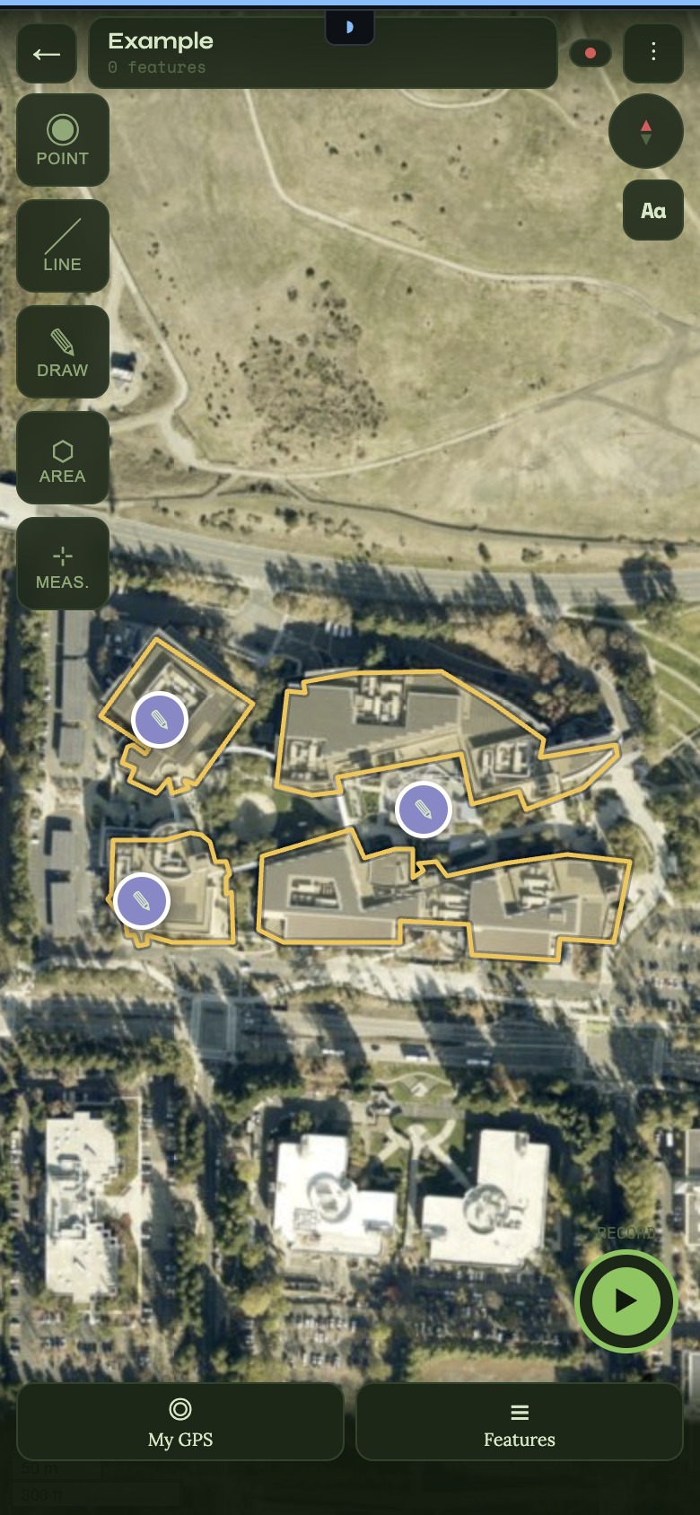
It turns out the same tool that's useful for managing a rural property is also useful for anyone who maps the outdoors — hikers tracking favourite trails and campsites, volunteers maintaining paths, smallholders planning fences, or anyone who just wants a private, offline way to record what they find.
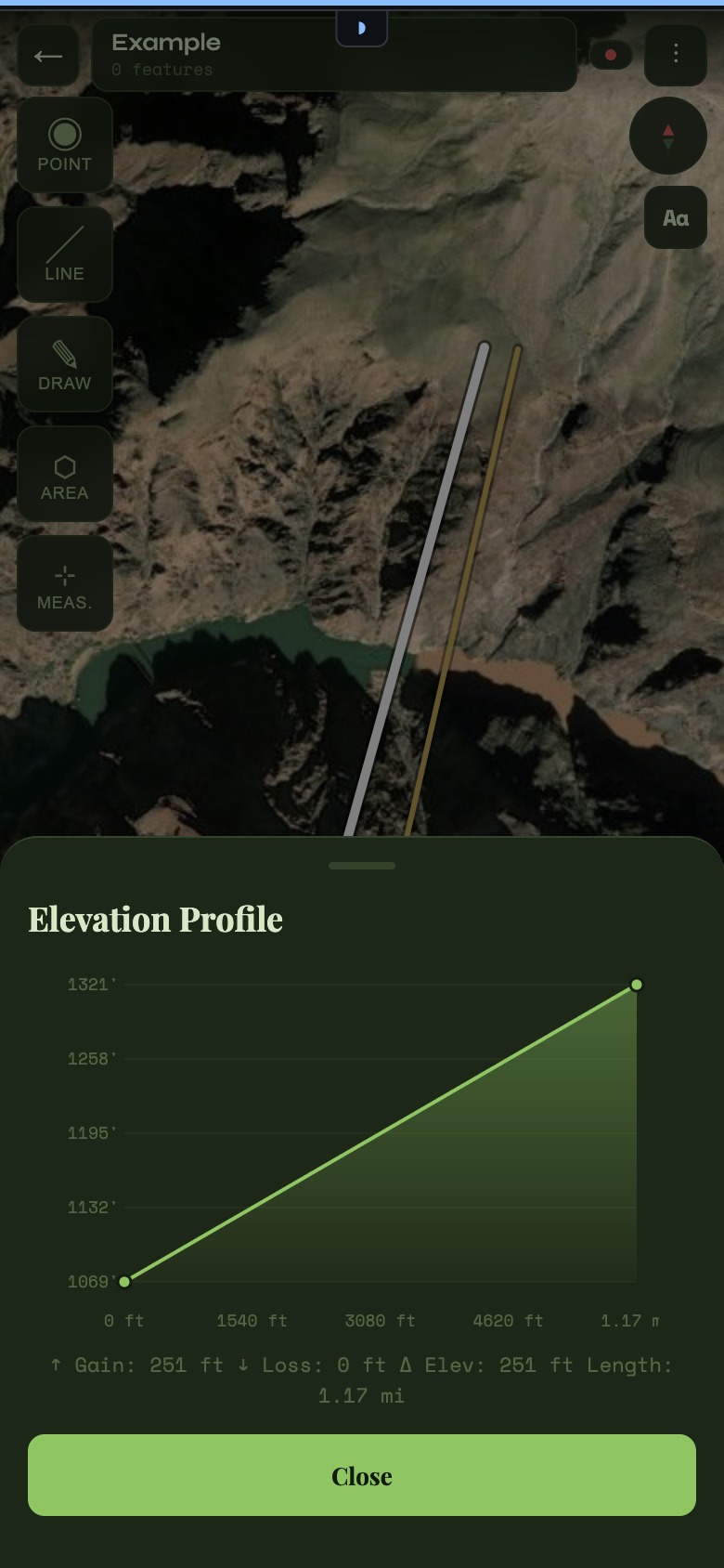
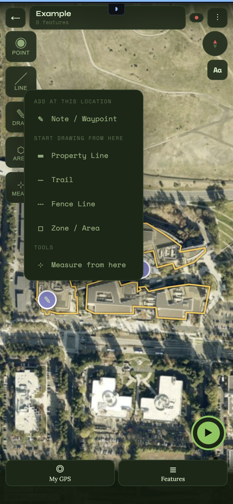
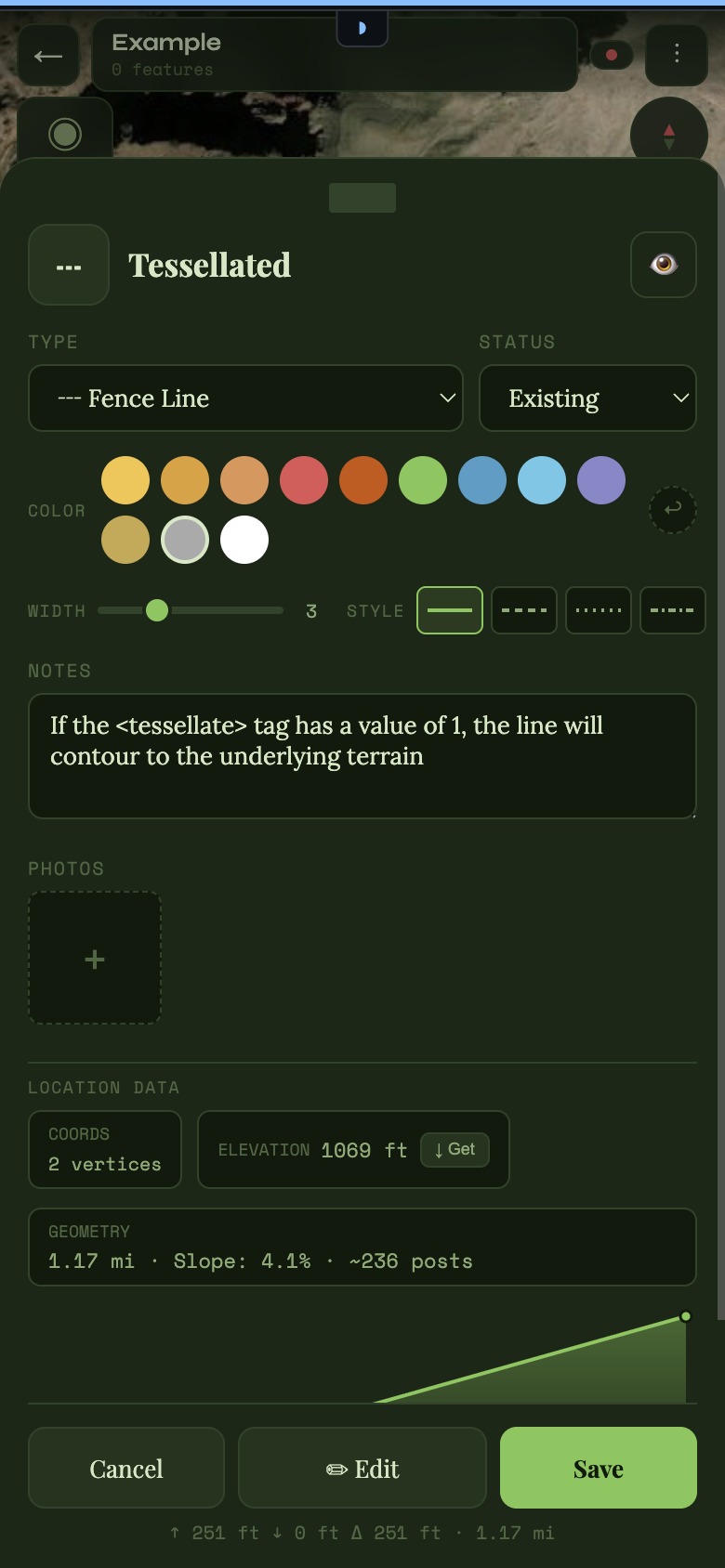
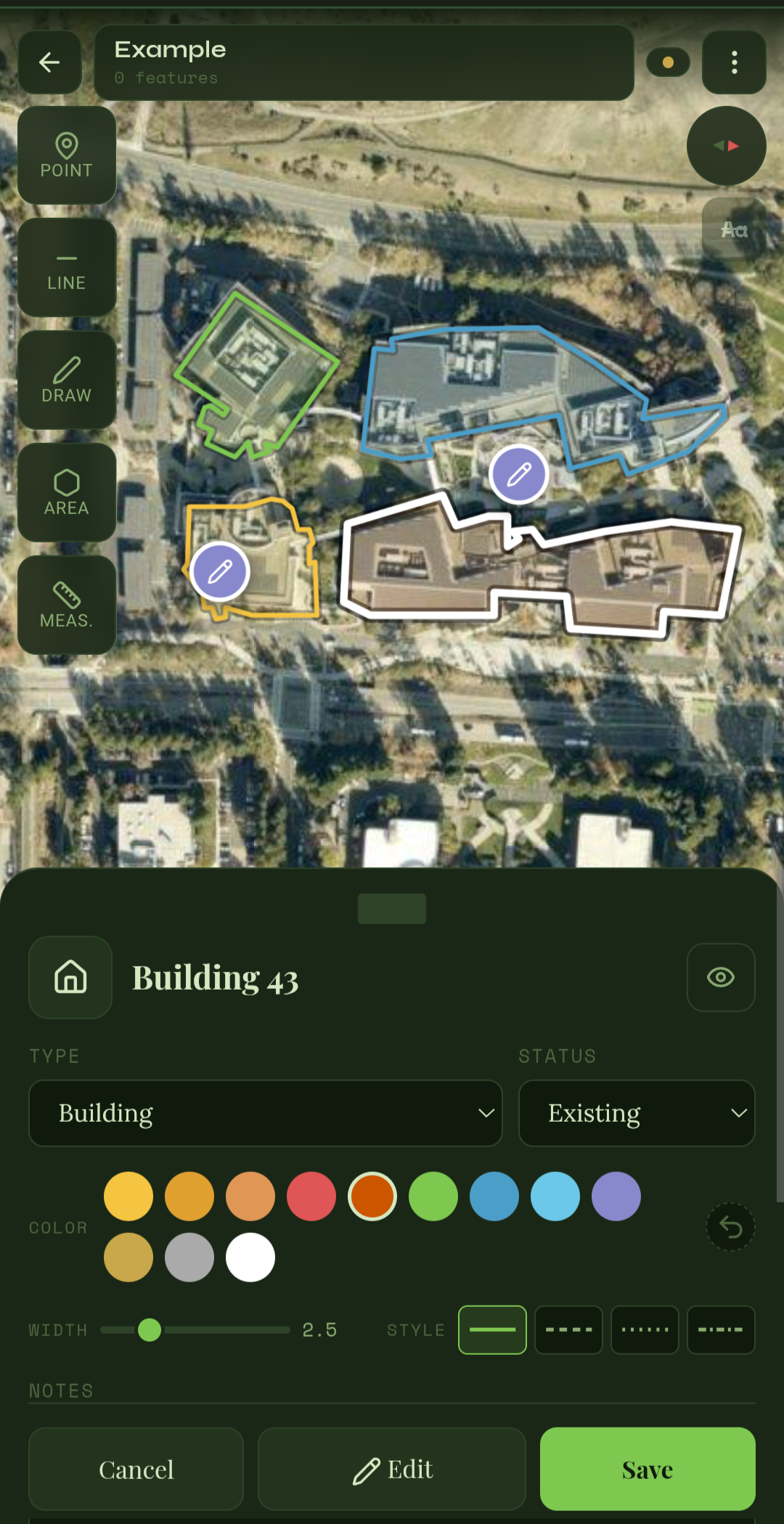
Cairn is the tool that should have existed already (TBH maybe it does and I just couldn't find it). It is real geometry drawing, elevation profiles, terrain analysis, GPS recording, 30+ feature types — all offline, no account required, and free.
Your data, your device
Everything lives locally. No account, no cloud, no one else's server. Export it whenever you want.
Built for the outdoors
30+ feature types designed around how people actually use land — not generic GIS layers.
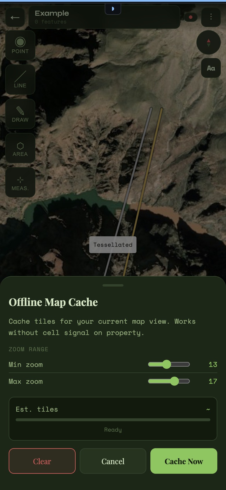
Works without signal
Offline tile caching means you can map your back forty even when there's no cell service.
Free. Genuinely.
The full tool. No marker limits, no feature caps, no trial period. Free.